


.jpg?width=4032&name=Image%20from%20iOS%20(40).jpg) The use of unmanned aerial vehicles (UAVs) or drones has risen steadily in the mining industry since the first application of them in this sector in the 2010s.
The use of unmanned aerial vehicles (UAVs) or drones has risen steadily in the mining industry since the first application of them in this sector in the 2010s. With the rise of automation technology, as well, they can go further, see more, and in higher resolution and with greater accuracy...all on a pre-programmed flight path, meaning that personnel can stay a safe distance away from potential hazards.
Mining and Safety
Mining can be an extremely hazardous job. In fact, in 2019, ISHN (Industrial Safety and Hygiene News) ranked “miner” as one of the top ten most dangerous jobs in America.
Interestingly, it is not only working underground that poses the biggest threat; the ISHN report cited transportation incidents as the leading cause of death for this group of workers. That is why, on our list of how drone deployment has made the mining industry safer, we include optimizing haulage roads.
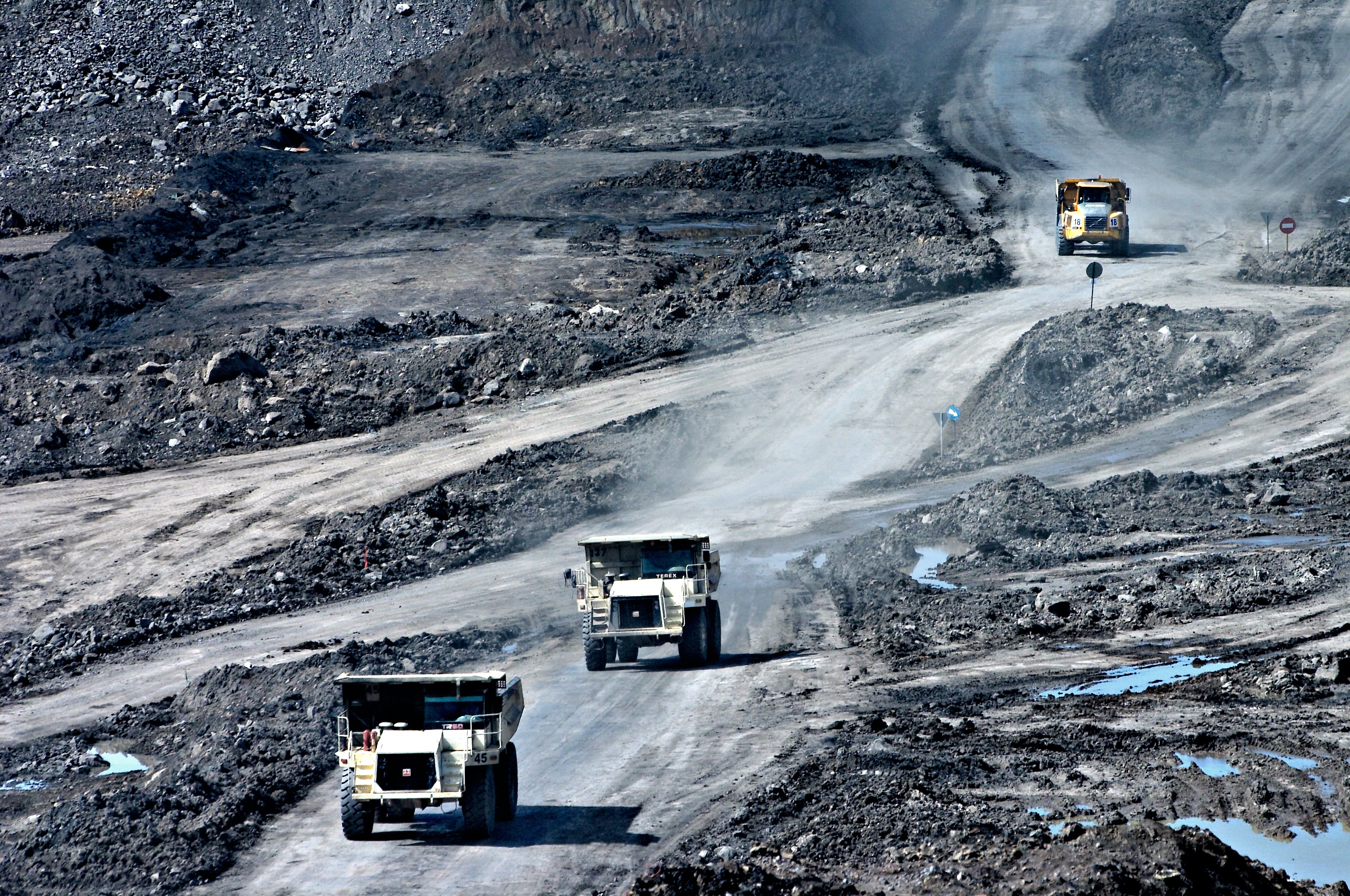 Collisions with and between large mining equipment have been a leading cause of safety incidents at mine sites. High-precision, high-resolution drone data enables engineers to identify problems on haulage roads to help avoid future accidents and equipment damage.
Optimizing Haulage Roads
The condition of the haulage roads around the mine site has a huge impact on operational efficiency. To make sure the roads remain smooth and unobstructed for vehicles to be able to pass over them, they must be consistently monitored. Not only does this improve the safety of the site, it means less damage and/or potential for accidents for on-site vehicles.
Drones make this process easier because they can cover larger areas from the sky, and with more precision. Engineers can then use the captured images and positional data to plan and carry out maintenance activities, making the roads safer for mining personnel.
By capturing this data from a distance with RTK-enabled drones, surveyors are also kept out of harm's way. Not only can they capture the data from a safe location, they no longer need to place ground control points (GCPs) to get the high precision data that is required.
Tailings Dam Monitoring
In our blog post titled, ‘Extracting Useable Minerals from Mining Waste’, we explored some of the potential hazards of storing mining waste in tailings storage facilities on a mine site.
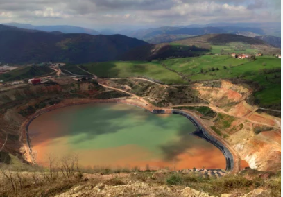 Tailings dam monitoring is an important safety regulation worldwide. IoT devices like piezometers and inclinometers can only capture data at the point of contact. Adding drone data makes the data more complete and helps to mitigate potential issues before damage occurs.
After an incident at the Brumadinho dam in Brazil, in which 270 people were killed, the Mining and Tailings Safety Initiative (MTSI) launched an investigation which found that 10% of dams surveyed showed clear signs of structural instability. The potential for injury or loss of life for personnel on these sites is a concern for all.
Using high-accuracy drone data and analytics to measure changes over time across the dam lowers this risk significantly. And used in conjunction with sensors and IoT devices like piezometers and inclinometers, the tailings dam engineers get an even broader digital view of potential issues to address.
Skycatch has automated UAV solutions for every kind of site and operation. Fill out this contact form and tell us what you’re looking for. We’d be happy to discuss the right solution for your project.

