


Capturing good, accurate data for highwall mining analysis has been a persistent challenge facing the mining industry, and we think it’s one worth improving. A sophisticated highwall mining data capture system gives geologists, geotechnical engineers, and industry executives access to deep mine-terrain insights that can help them make smarter operational decisions for ore extraction. It can also enable significant efficiency boosts and save lives.
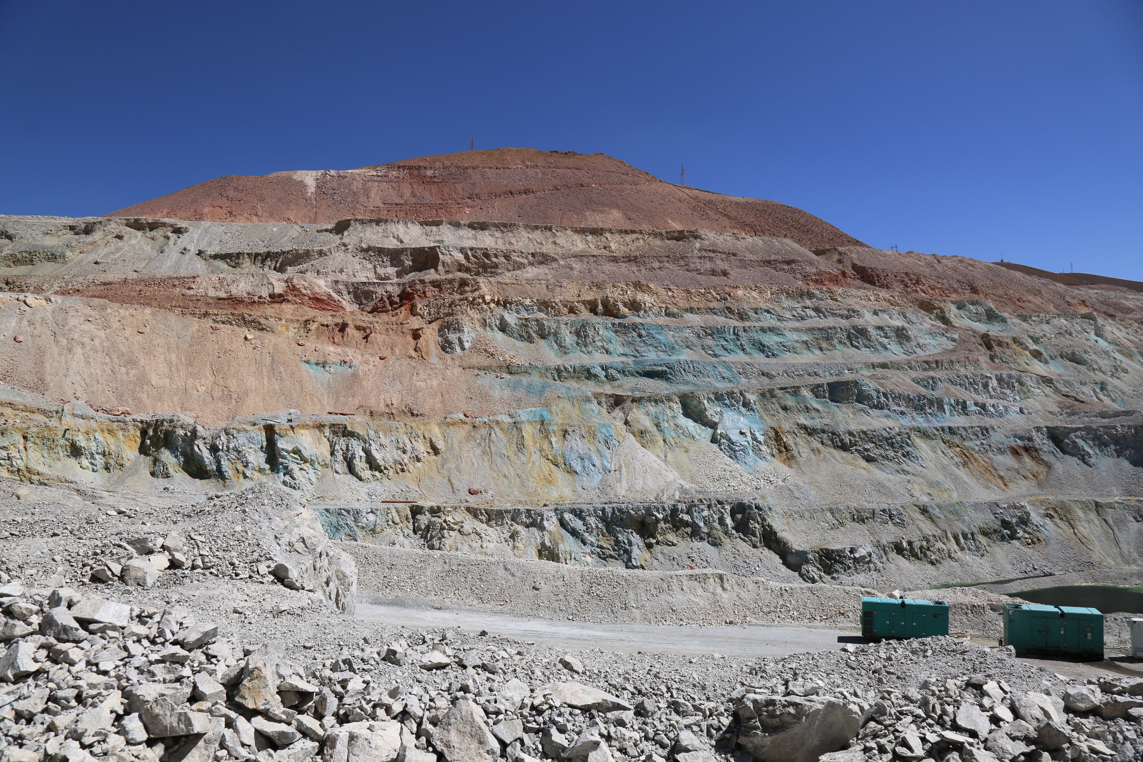
Traditionally, mining surveyors capture information for geologists, planners, geotechnical engineers and others planning for ore extraction in the most efficient and safe way possible. These surveyors are often the busiest people in the entire mining operation because everyone else’s work depends on their ability to collect mining data accurately. Not surprisingly, this team can become an operational bottleneck.
Moreover, many surveyors are regularly exposed to dangerous environments and their work can take them to several highly unpredictable areas within a mine. They’re also limited by legacy highwall mining technology that isn’t always easy to use, meaning data isn’t always appropriately captured.
Transforming Highwall Mining From the Top
Skycatch’s advanced highwall scanning solution for unmanned aerial vehicle (UAV) 3D mapping, data processing, and drone analytics lets firms maximize their investment in modern highwall mining software and generate the data geologists and engineers need. Our highwall mining survey technology also provides a level of detail that only the most expensive and technically complicated high-end laser scanners can rival.
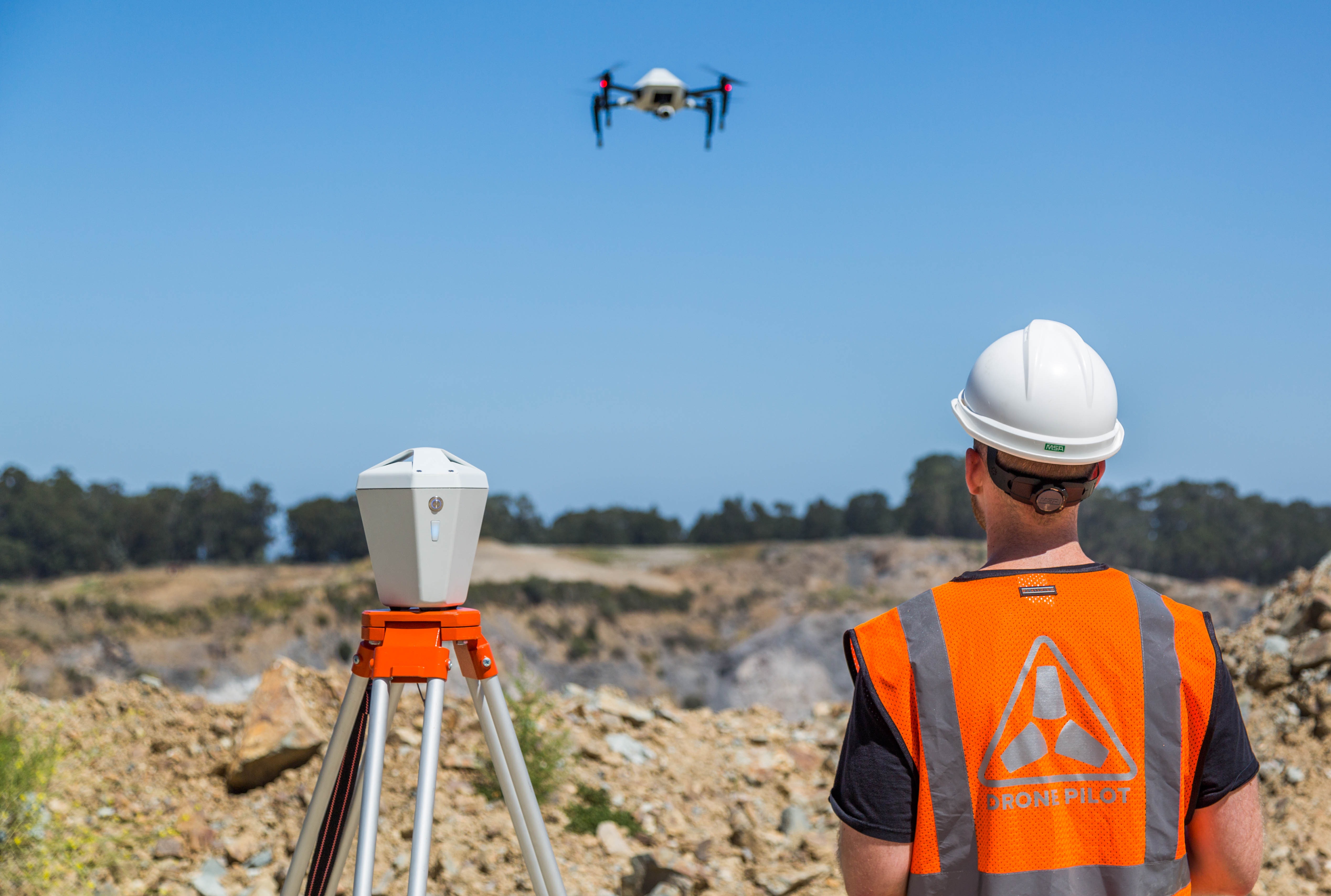
Drone data with the Skycatch mining solution provides 3D data accurate to within five centimeters. Again, mining industry data analytics can help leaders make critical strategic decisions, implement appropriate safety measures, and accomplish plenty of other objectives as the industry becomes increasingly competitive.
Here’s how we’ve seen it work:
-
It allows engineers to anticipate potential issues. Failures are rarely acute in mining — they occur gradually over time. A collapse is often precipitated by a bulge or other slight movement, which can take weeks or months to form, in areas that might not have been monitored regularly given the survey bottleneck and safety risks on the capture side. Identifying small warning signs in highwall mining much earlier can prevent hundreds of millions of dollars in lost revenue for mining companies.
-
It removes job-related risks for surveyors. Survey teams often have to climb benches to get a full highwall evaluation and collect mining data, which puts human lives in danger. When a drone can remotely capture the same data, surveyors can do their jobs without risking their safety.
-
It improves highwall mining data accuracy and visual detail. Real-time kinematic (RTK) enabled drones yield a far more accurate output in a safer way than traditional approaches using ground control points (GCP's). Used in conjunction with the Edge1 Smart Base Station, it gives them a more accurate representation of the physical world down to 5 cm or less. That means they can better pinpoint the location of ore bodies and improve efficiencies in mineral extraction.
The opportunity to collect better highwall mining data on a more consistent basis introduces many new opportunities for companies, and using drones for data capture mitigates some of the most significant risks associated with surveying the highwalls.
Learn more about the Skycatch end-to-end mining solution and take advantage of the next generation of highwall 3D data capture, processing and analysis. Download our paper entitled "Is There A Better Way To Get 3D Highwall Data" here.

