5 Awesome Ways To Bring Skycatch Data Into Your Construction Workflows

Get The Data You Need, Right Now
With fast and flexible in mind, we are proud to introduce the Direct Export feature: With a single click, you can quickly and easily download your drone data into four nearly-universal formats, for immediate use within the programs that you already use every day.
Based on years of working directly in the field with our customers, we’ve prioritized the following four file types to release first (with many more to come):
TIFF
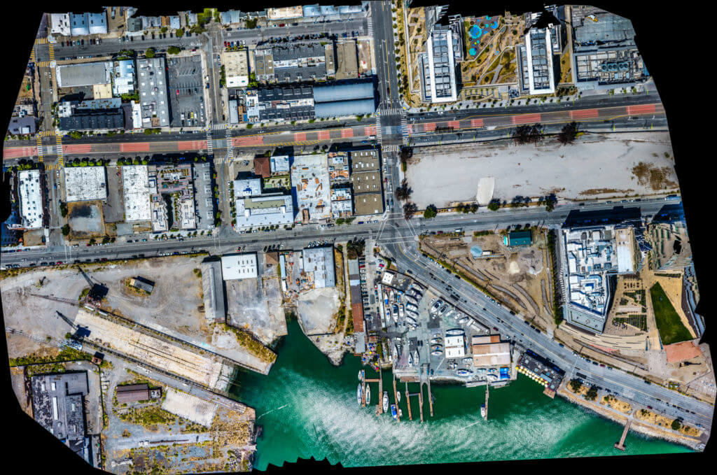 High resolution TIFF, ready for importing into Bluebeam for markups
Export your entire map as a super high-resolution TIFF and send it to your BIM/VDC team for markups in Bluebeam, or simply print it out to show up-to-date progress.
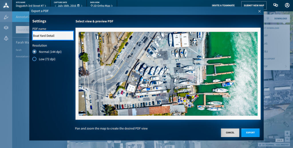 Export custom views of your site as PDFs and incorporate them into your workflow
Our PDF option lets you isolate a section of your map, which you can then export and share for a more detailed view of your site.
LAS
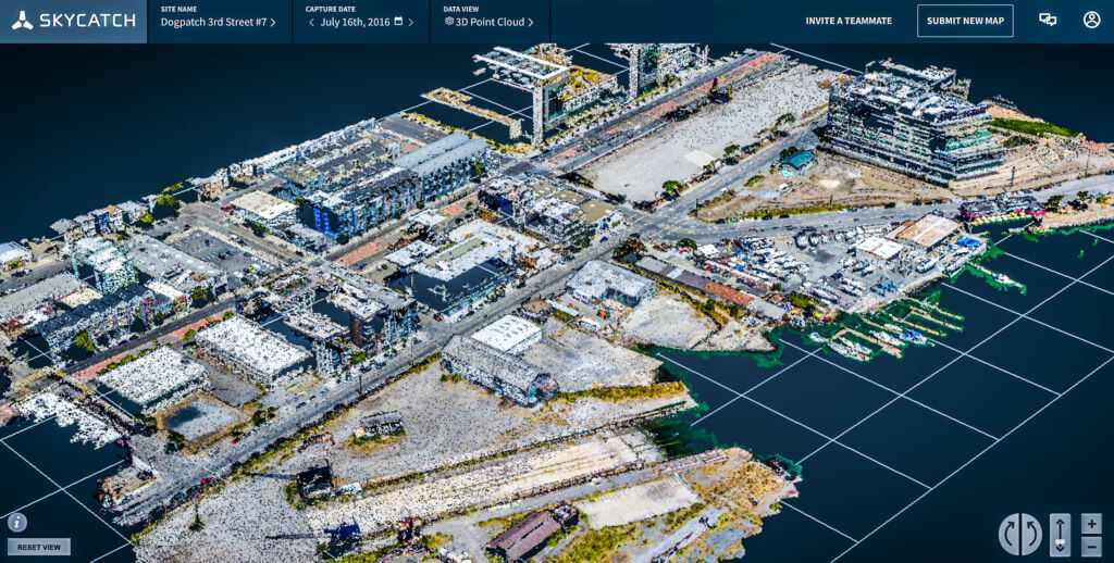 Skycatch generated LAS file
 Download your site as a point cloud and import into programs like Revit, Navisworks, Civil3D, or any other CAD software.
During the feature building process, we worked closely with Dave, an Earthworks Project Manager who led the grading phase in his project and likes to use Civil3D. Before using Skycatch’s 3D point cloud, Dave used to have a point cloud generated by a laser scanner. That process was costly and cumbersome, as Dave would need to wait multiple days for the point cloud file to be delivered. Dave doesn’t have to wait any more.
Using Skycatch, Dave gets the point cloud file in less than two hours, instantly downloads it and imports it to Civil3D for further analysis. The point cloud can be turned into a contour lines file using a Civil3D feature. The contour lines file can then be used for slope calculation and grading validation and control. Dave gets insight to his Earthworks management instantly with no hurdles of adopting a new software or waiting for a file that he can get within couple of hours by using Skycatch.
Generating 3D models for proposals used to take 2 days...now it takes just over an hour
OBJ
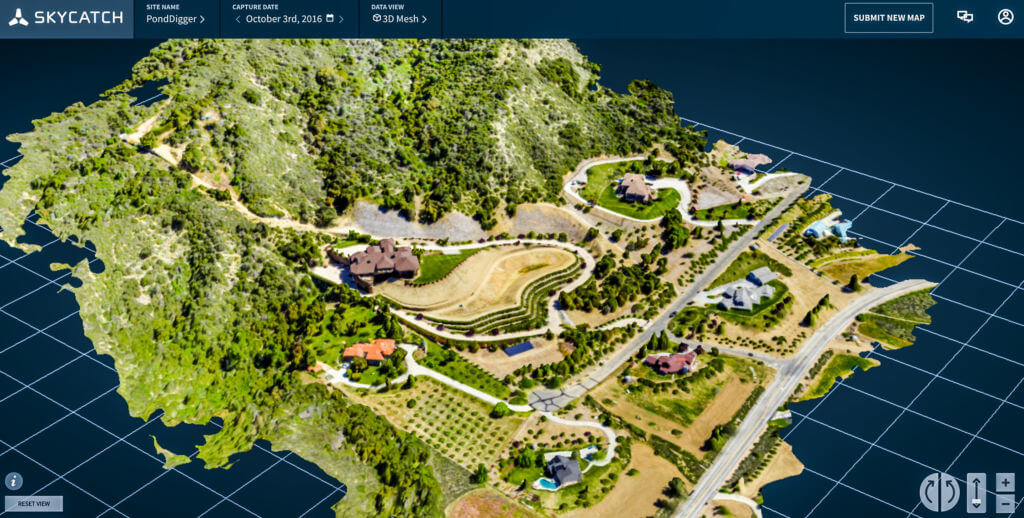 Skycatch generated OBJ to be used for creating a proposal
Download your site as a 3D mesh for a more realistic view. One of our customers, Richard, flies over his sites during pre-construction to capture 3D models of the surrounding buildings and incorporates those models into his proposals. Generating the surrounding buildings by himself used to require as much as 2 days for research and building the models manually in Sketchup - now it takes a 15 minute flight and an hour of processing before he’s ready to go.
Contour, DTM, & DSM
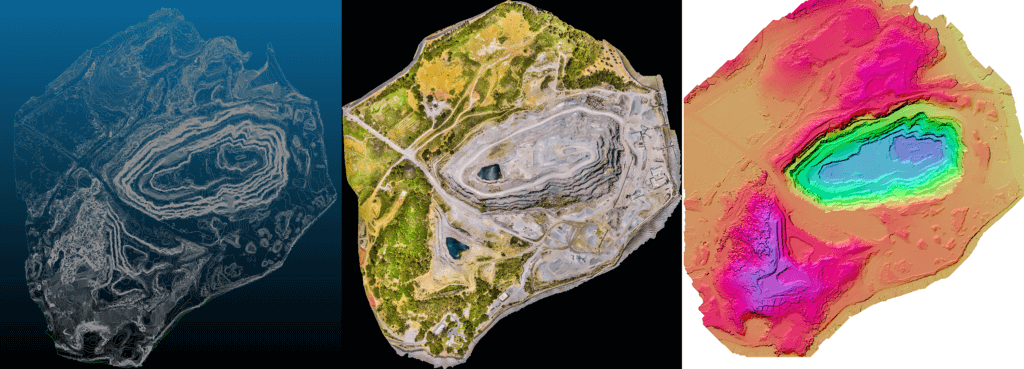 Upgrade to the Enterprise plan for contour, DTM, & DSM exports
Get an even greater understanding of your site with contour, DTM, or DSM exports, available on our Enterprise data package.
Contour Lines: Utilize the DXF export function and get instant site slope evaluation, or validate grading or curving plains
DTM: Before tearing down an old site, get true insight into your terrain shape and structure, complete with automatic object and vegetation removal
DSM: Perfect for getting better insight to surface shape and structure in the early stage of your project
There is limitless flexibility using this feature. Keep using your existing workflow and tools, while adding accurate, high resolution data that’s delivered quickly in the format you need. Join the hundreds of construction professionals who use Skycatch data all over the world and apply their knowledge and skills on the data to connect their teams to the physical world.
Take advantage of these new features by logging in or starting your free 30-day trial with unlimited maps, no credit card required.
Ready to upgrade to the Enterprise package? Get in touch with us.
Need help or have feedback? Start a conversation on the Skycatch Forum.
By Tom Zaiderman, Product Manager, Web, Cloud and Mobile Platforms


